


Beloit Township Voting District, Mitchell County, Kansas
About
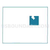
Outline

Summary
| Unique Area Identifier | 585958 |
| Name | Beloit Township Voting District |
| County | Mitchell County |
| State | Kansas |
| Area (square miles) | 31.76 |
| Land Area (square miles) | 31.76 |
| Water Area (square miles) | 0.00 |
| % of Land Area | 99.99 |
| % of Water Area | 0.01 |
| Latitude of the Internal Point | 39.42964800 |
| Longtitude of the Internal Point | -98.10470870 |
Maps


Graphs
Select a template below for downloading or customizing gragh for Beloit Township Voting District, Mitchell County, Kansas


Neighbors
Neighoring Voting District (by Name) Neighboring Voting District on the Map
- Asherville Township Voting District, Mitchell County, KS
- Beloit City Ward 1, Mitchell County, KS
- Beloit City Ward 2, Mitchell County, KS
- Beloit City Ward 3, Mitchell County, KS
- Beloit City Ward 4, Mitchell County, KS
- Bloomfield Township Voting District, Mitchell County, KS
- Center Township Voting District, Mitchell County, KS
- Logan Township Voting District, Mitchell County, KS
- Lulu Township Voting District, Mitchell County, KS
- Plum Creek Township Voting District, Mitchell County, KS
- Solomon Rapids Township Voting District, Mitchell County, KS
- Turkey Creek Township Voting District, Mitchell County, KS
Top 10 Neighboring County Subdivision (by Population) Neighboring County Subdivision on the Map
- Beloit city, Mitchell County, KS (3,835)
- Beloit township, Mitchell County, KS (205)
- Logan township, Mitchell County, KS (125)
- Turkey Creek township, Mitchell County, KS (122)
- Plum Creek township, Mitchell County, KS (105)
- Asherville township, Mitchell County, KS (97)
- Lulu township, Mitchell County, KS (87)
- Bloomfield township, Mitchell County, KS (76)
- Solomon Rapids township, Mitchell County, KS (65)
- Center township, Mitchell County, KS (39)